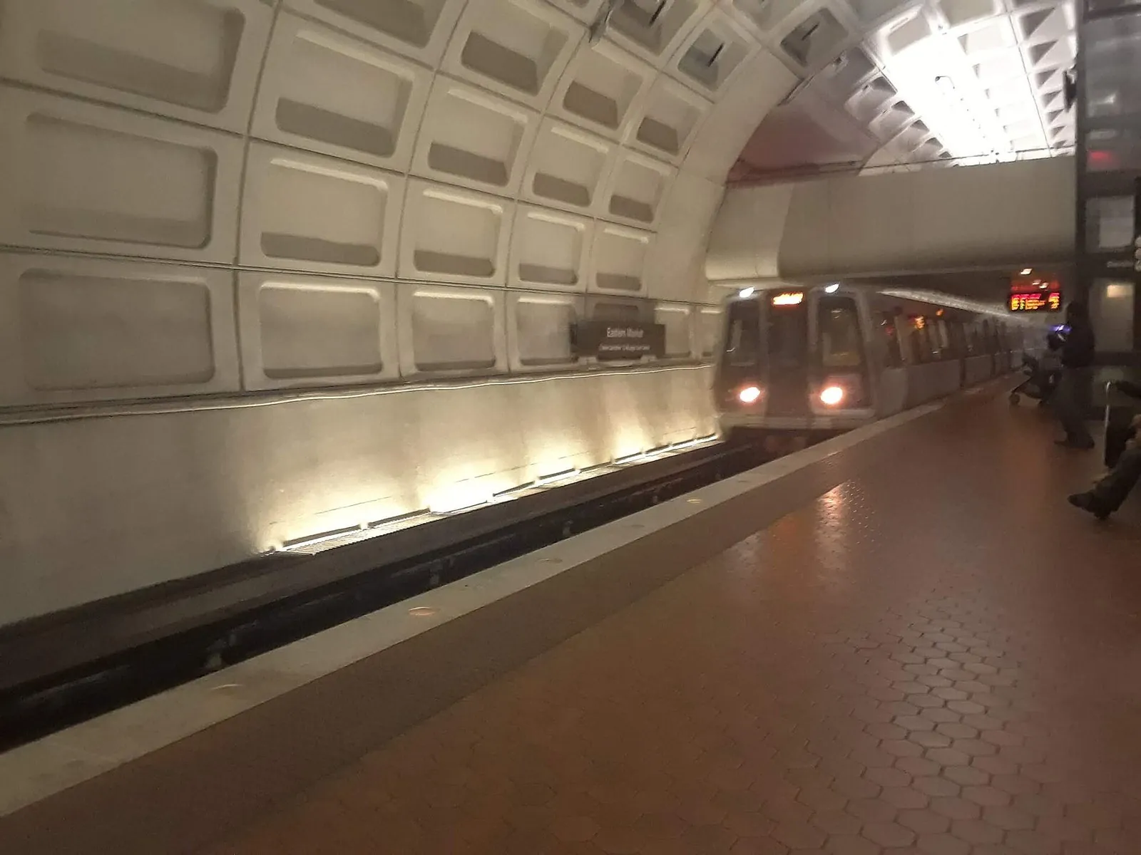
Plenty of guides to getting around Washington DC still tell you to hop on the DC Circulator, the cheap red buses that looped the National Mall. They stopped running on December 31, 2024, and nothing replaced them. That’s the first thing to know. The second is better news: DC is one of the easiest American cities to see without a car. Six Metro lines run under the city, including three straight beneath the Mall, you can tap a phone or bank card at the fare gates, and most of what you came to see is within walking distance of a station. Add a bike-share bike or the occasional rideshare, and you’ll never need to think about parking.
Quick answer: The best way to get around Washington DC is Metro plus walking. Rail fares run $2.25 to $6.75 depending on distance and time, a one-day pass costs $13.50, and you can pay by tapping a contactless card or phone, as of September 2026. Capital Bikeshare and dockless scooters cover short hops, and rideshares fill the gaps late at night. Don’t drive in the city center unless you have to: parking is scarce and costly, and there’s no longer a shuttle bus on the Mall.
Last updated September 24, 2026. Fares, hours, rules and service changes were checked that day against WMATA’s, DDOT’s and the operators’ own websites.
- Metro fares: $2.25 to $6.75 on weekdays before 9:30 p.m.; $2.25 to $2.50 at other times. Bus fare $2.25.
- Passes: 1-day $13.50, 3-day $33.75, 7-day $60.75, on a SmarTrip card or phone wallet.
- Tap to pay: contactless cards and phones work at rail gates (since May 2025) and on buses (since November 18, 2025).
- Kids: up to two children age 4 and under ride free with each paying adult.
- Gone: the DC Circulator ended December 31, 2024. Metrobus routes were all renamed on June 29, 2025.
On this page: Options at a glance | Metro | Metrobus | The Circulator | Walking | Bikes and scooters | Taxis and rideshare | Driving and parking | Water taxi | Arriving by train, bus or car | How to reach each sight | The 10 most common trips | Saving money | Metro tips | Big events | FAQ
Getting Around Washington DC: Your Options at a Glance
Prices are as of September 2026.
| Mode | Best for | Cost | Watch out for |
|---|---|---|---|
| Metro (rail) | Almost everything: the Mall, Arlington, neighborhoods | $2.25-$6.75 a ride; passes from $13.50 a day | Yellow trains end at Mt Vernon Square; tap out as well as in |
| Walking | Within the Mall and each neighborhood | Free | Distances are bigger than they look |
| Metrobus | Crosstown trips, Georgetown | $2.25 | All routes renamed in 2025; old numbers are wrong |
| Capital Bikeshare | Short hops, the Mall, riverside paths | $1 unlock + 15 cents/min classic; $10 day pass | Busy docks near the Mall at peak times |
| Dockless scooters and e-bikes | Quick trips of a mile or two | Per-minute pricing by operator | No sidewalk riding downtown; strict parking rules |
| Rideshare and taxis | Late nights, Georgetown, luggage | Varies with demand | Traffic and road closures around events |
| Driving | Day trips out of the city | Meters about $2.30/hour; garages extra | Scarce parking, strict enforcement |
| Water taxi | The Wharf, Georgetown, Old Town, National Harbor | About $22 one way (adult) | Seasonal, March to December |
Metro: How DC’s Subway Works
Metrorail, run by the Washington Metropolitan Area Transit Authority (WMATA), is the backbone of any DC visit. Six color-coded lines, Red, Orange, Blue, Silver, Green and Yellow, fan out from downtown into Maryland and Virginia, and trains reach the Mall, Arlington, Old Town Alexandria and both nearby airports. Stations are clean, vaulted and easy to navigate, and every one has elevators.
The lines that matter most to visitors
The Blue, Orange and Silver lines share a tunnel under the Mall, with stations at Smithsonian (the middle of the Mall), Federal Triangle (the north side’s museums) and L’Enfant Plaza (the south side’s museums and the Wharf), plus Foggy Bottom-GWU for the Lincoln Memorial end, Capitol South for the Capitol and Eastern Market for Capitol Hill. The Blue line also runs to Arlington Cemetery, and Blue and Yellow trains serve Reagan National Airport. The Silver line runs west to Dulles Airport, which it has served directly since November 2022.
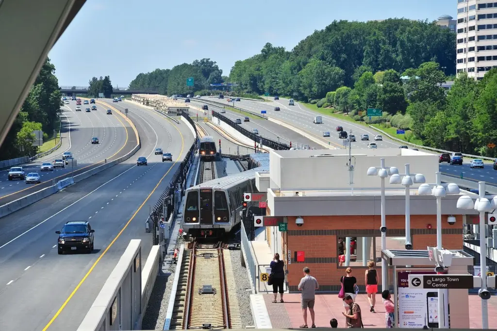
The Red line doesn’t touch the Mall, but it links Union Station, Judiciary Square, Gallery Place-Chinatown, Metro Center, Farragut North, Dupont Circle, Woodley Park and Cleveland Park, for the zoo. The Green and Yellow lines run north to south through Gallery Place and Archives. Since 2023, Yellow trains end at Mt Vernon Square, so U Street, Shaw-Howard, Columbia Heights, Waterfront and Navy Yard are Green line stations only. Check which line you need before you board.
Fares and passes
Fares depend on distance and time of day. As of September 2026, rail trips cost $2.25 to $6.75 on weekdays before 9:30 p.m., and $2.25 to $2.50 late on weeknights and all weekend. Most trips within central DC fall at the low end. Transfers between bus and rail are free within two hours on the same card.
Unlimited passes cost $13.50 for one day, $33.75 for three days and $60.75 for seven, loaded on a SmarTrip card or a phone wallet. A one-day pass only pays off if you’ll take four or more rides at peak fares, or several longer trips; for a typical sightseeing day of two or three rides, pay as you go.
How to pay
You no longer need a special card. Contactless bank cards and phone wallets work at the rail fare gates, where they’ve been accepted since May 2025, and on buses, since November 18, 2025. Tap the card reader when you enter and again when you leave, since rail fares are calculated by distance. A SmarTrip card, physical or in your phone’s wallet, is still the way to load passes.
Hours
Trains run Monday to Thursday from 5 a.m. to midnight, Friday from 5 a.m. to 2 a.m., Saturday from 6 a.m. to 2 a.m. and Sunday from 6 a.m. to midnight, as of September 2026. Trains run less often late at night and on weekends, and weekend track work sometimes means single-tracking or station closures, so check WMATA’s service alerts before you set out.
Children, etiquette and accessibility
Up to two children age 4 and under ride free with each fare-paying adult; kids 5 and older pay the regular fare. On escalators, stand on the right and walk on the left, a rule DC commuters take seriously. Every station has elevators, though one is occasionally out of service; WMATA posts elevator outages on its site, which is worth checking if you rely on a stroller or wheelchair. Our dedicated Metro guide covers the system, the map and fares in more depth.
Metrobus and the Better Bus Network
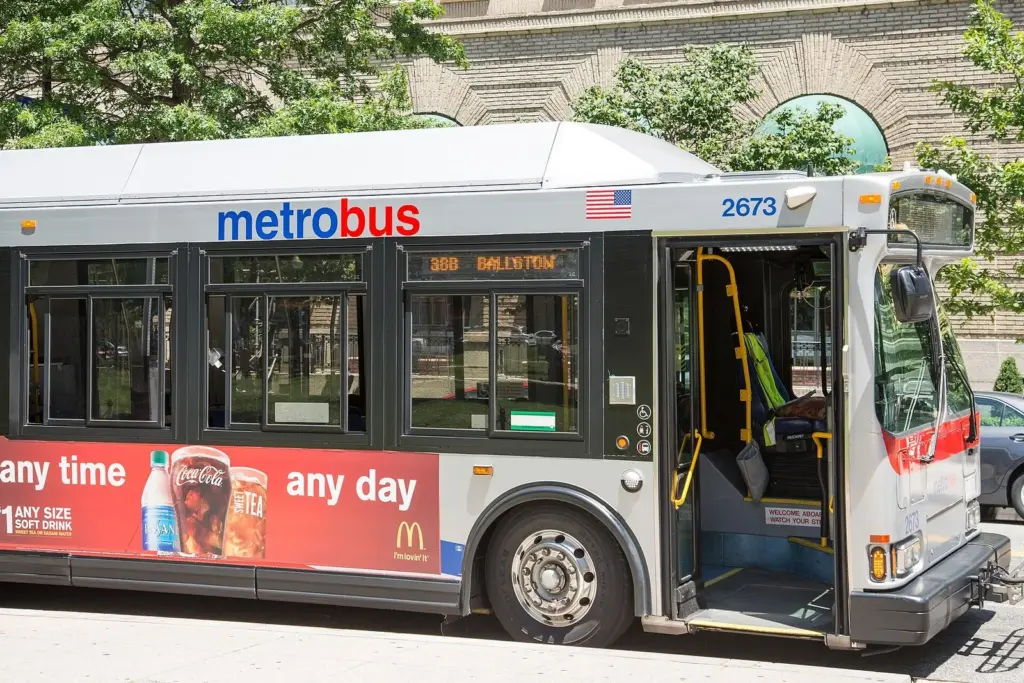
Metrobus fills the gaps the trains leave, especially for crosstown trips and for Georgetown, which has no Metro station. On June 29, 2025, WMATA launched its Better Bus Network, the first overhaul of the system in 50 years. Every route got a new name based on where it runs: routes starting with C are crosstown DC routes, D routes serve downtown DC, and prefixes such as A and P cover Arlington and Alexandria and Prince George’s County. The redesign also cut about 5% of stops to speed buses up.
That means any route number in a guide written before mid-2025 is likely wrong. Use WMATA’s trip planner or a maps app, which have the new routes. The fare is $2.25, you can tap a contactless card or phone, and a transfer to or from rail within two hours is free.
The DC Circulator Is Gone
For years, the DC Circulator’s cheap buses were the easiest way to hop around the Mall, Georgetown and Union Station. The whole system shut down on December 31, 2024, including the National Mall route. The city pointed riders to regular Metrobus routes instead, and there’s no dedicated shuttle loop on the Mall today. If a guide or app tells you to catch the Circulator, it’s out of date.
What to use instead: walk the Mall in sections and use the Smithsonian, Federal Triangle, L’Enfant Plaza and Foggy Bottom-GWU stations to hop between its ends. For Georgetown, take a Metrobus, walk from Foggy Bottom-GWU or Rosslyn, or use a rideshare. Paid hop-on, hop-off tour buses run around the main sights, but they’re a tour product rather than transit.
Walking: How Walkable Is DC?
Very, within each area, and much of the city’s best sightseeing is on foot. The trouble is scale. From the Lincoln Memorial to the Capitol is about 2 miles, the Tidal Basin loop is about 2 more, and a full day on the Mall easily runs to 6 or 7 miles. Distances that look like a short stroll on a map can take 20 or 30 minutes.
Some rules of thumb. The Washington Monument to the Lincoln Memorial is a little under a mile, about 20 minutes. The Mall’s north side, from the Capitol to the African American history museum, takes about 25 minutes to walk end to end. From Smithsonian station to the Jefferson Memorial is about 20 minutes. Crossing the Mall from one row of museums to the other takes five.
Walking tips: the gravel paths down the middle of the Mall are the most direct routes, but the paved sidewalks along Madison and Jefferson Drives are easier on feet, strollers and wheels. Summer heat is the main hazard, with July averaging a high of 89.6°F, so carry water and use the museums as air-conditioned rest stops. DC’s grid is easy to learn: numbered streets run north to south, lettered streets run east to west, and state-named avenues cut across diagonally, while the Capitol divides the city into four quadrants, NW, NE, SW and SE. Always check the quadrant; 700 F Street NW and 700 F Street SE are far apart.
Capital Bikeshare, Scooters and E-Bikes
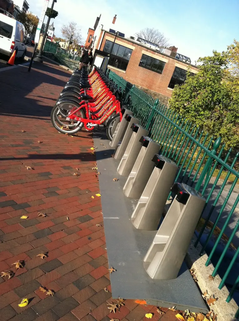
Capital Bikeshare is the region’s docked bike-share system, with stations all around the Mall, the neighborhoods and Arlington. As of September 2026, a ride costs $1 to unlock plus 15 cents a minute on a classic bike or 35 cents a minute on an e-bike, or you can buy a $10 day pass with unlimited 45-minute classic rides (e-bikes add 15 cents a minute on the pass). An annual membership is $120. It’s an excellent way to cover the Mall’s long distances, and the riverside paths past the memorials make a lovely ride.
Dockless scooters and e-bikes are everywhere too. DDOT permits four operators: Lime, Lyft, Spin and Veo, which all run scooters, while Lime, Spin and Veo also offer dockless e-bikes. You unlock them through each company’s app and pay by the minute. Two rules matter: there’s no sidewalk riding downtown, so use bike lanes or the street, and when you’re done you must lock a scooter to a bike rack, an in-street corral, a signpost or a stop sign rather than leaving it loose on the sidewalk.
For a longer ride, about 5 miles of upper Beach Drive in Rock Creek Park are closed to cars full-time, year-round, which makes it one of the best family and leisure cycling routes in the city. Our Bikeshare guide covers the system in more detail.
Taxis and Rideshare
Uber and Lyft operate throughout the region, and taxis can be hailed downtown or found at ranks at Union Station and the airports. Rideshares are most useful late at night, after Metro closes; for getting to and from Georgetown, which has no station; for luggage; and for groups of three or four, when a shared ride can cost about the same as several Metro fares. The downsides are traffic at rush hour and road closures around big events and security zones, which can make a short ride slow and expensive. Around the Mall, pickup points can be awkward, so walk a block or two to a side street where drivers can stop.
Driving and Parking in DC
The short version: don’t drive in the city center if you can avoid it. Parking near the Mall and in the busiest neighborhoods is scarce, enforcement is strict, and DC’s traffic cameras issue tickets for speeding, red lights and more. Metro and walking will get you everywhere on a typical itinerary faster and cheaper.
Street parking. Most DC parking meters charge about $2.30 an hour, with premium zones near the White House and Dupont Circle costing more, around $3.75 an hour. Meters typically run Monday to Saturday from 7 a.m. to 6:30 p.m., but in high-demand areas, including the National Mall, U Street and Penn Quarter and Chinatown, enforcement runs until 10 p.m. Most meters are free on Sundays and federal holidays, but rules vary by block, so always read the posted sign. You can pay with the ParkMobile app. Watch for rush-hour no-parking zones on major roads, where cars are towed.
Parking at the sights. The National Zoo charges $30 for parking bought a day or more ahead and $40 on the day. The Udvar-Hazy Center charges $15. The Reagan Building garage near the National Children’s Museum starts at $20 for one to two hours. Spaces near the Mall itself are limited, metered and fill early, especially on weekends and during events. Our parking guides cover the Mall and the rest of the city in detail.
When a car helps. Driving makes sense for day trips that are awkward by transit, such as Mount Vernon, Great Falls Park, the Udvar-Hazy Center and the National Arboretum. If you’re staying in Arlington or Alexandria, where hotel parking is usually cheaper, you can leave the car there and ride Metro into the city.
The Potomac Water Taxi
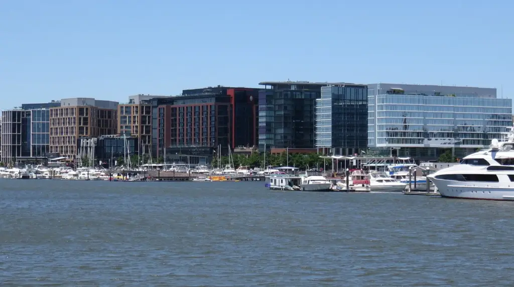
The most scenic way to get around is by boat. The Potomac Water Taxi, run by City Cruises, links the Wharf with Georgetown and Old Town Alexandria in about 30 minutes each, and with National Harbor in about 45. In 2026, the first departure from the Wharf was at 11:45 a.m., with boats every 30 to 60 minutes after that, and an adult one-way fare was about $22. It runs from March to December. It’s slower and pricier than Metro, but it doubles as a river tour, and it’s the easiest way to reach Georgetown’s waterfront from the Wharf. The Georgetown dock isn’t fully accessible, so check before you go if that matters.
Arriving by Train, Bus or Car
By train: Union Station
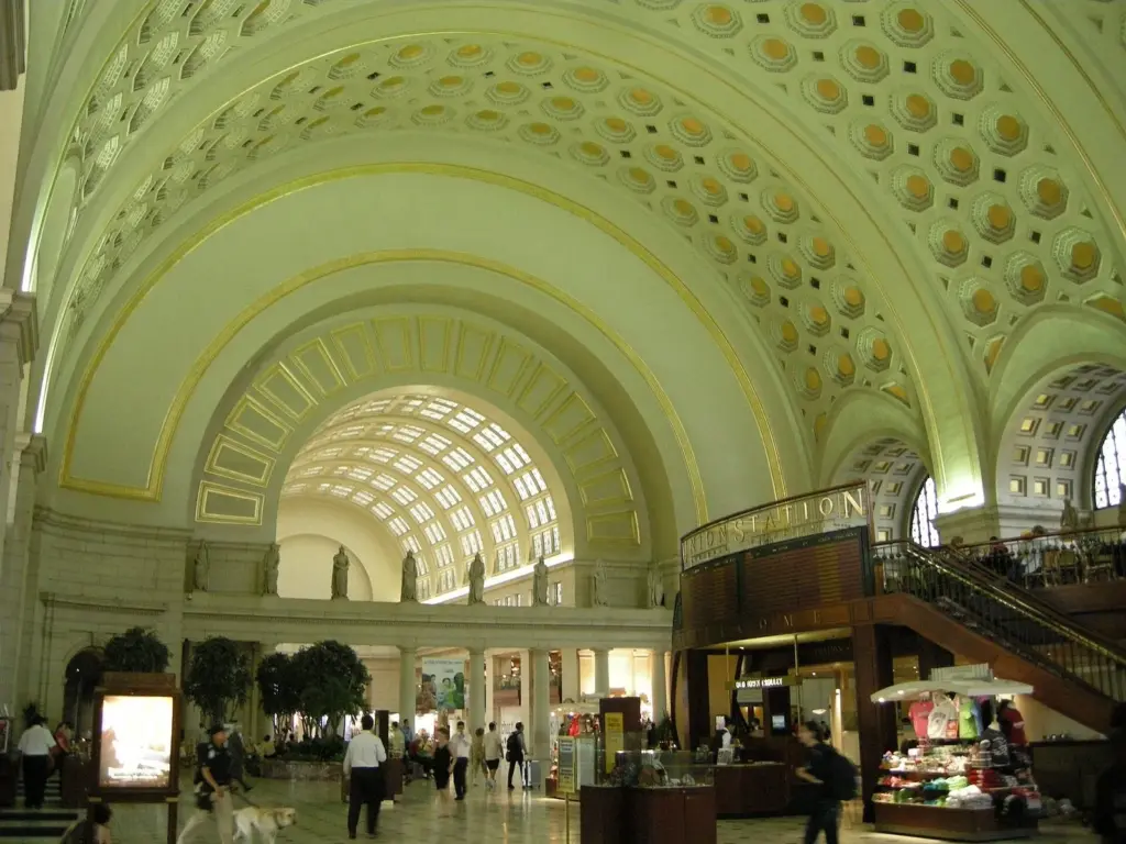
Washington Union Station, on the edge of Capitol Hill, is Amtrak’s second-busiest station and the arrival point for trains from New York, Philadelphia, Boston and beyond, as well as MARC commuter trains from Maryland and VRE trains from Virginia. It’s a 10-minute walk from the Capitol, and it has its own Red line Metro station. The federal Department of Transportation took the lead role in redeveloping the station in 2025, and in May 2026 it announced a $466 million investment in the roof, concourses, ticketing, retail, parking and signage, so expect construction. New food tenants announced in August 2026 include Andy’s Pizza, Housebar, Capo Deli, Joe & The Juice and Springbone Kitchen.
From New York, Amtrak’s Acela is the fastest option; its NextGen trainsets entered service on August 28, 2025, with all 28 due by 2027, and one-way Acela fares range roughly from $100 to $500 depending on the date. The Northeast Regional is slower and usually cheaper. Book early for the best fares. Our New York-to-DC guides compare the train, bus and car in detail.
By bus
Intercity buses from New York and other East Coast cities are usually the cheapest option. Several operators serve DC, with stops at or near Union Station and at curbside locations elsewhere in the city; the pickup point depends on the company, so check your ticket carefully. Long-term plans for Union Station include a new bus facility on a deck over the tracks.
By car
DC sits on the Interstate 95 corridor, with the Capital Beltway (I-495) ringing the city. Driving in is easy on a map and slow in practice: traffic on I-95 and the Beltway can be heavy at rush hour and on Friday afternoons. Once you arrive, park at your hotel and use Metro, or stay in Arlington or Alexandria near a station, where parking is usually cheaper.
By plane: Reagan National Airport is minutes from downtown on the Blue and Yellow lines, Dulles is on the Silver line, and BWI is linked to Union Station by train. Our airports guide covers transfers from all three.
How to Get to Each Major Sight
The nearest Metro station for the sights most visitors plan around, as of September 2026. Walking times are approximate.
| Sight | Nearest Metro (lines) | Walk | Also works |
|---|---|---|---|
| Washington Monument, Mall museums | Smithsonian (Blue, Orange, Silver) | 5-10 min | Federal Triangle, L’Enfant Plaza |
| Lincoln Memorial | Foggy Bottom-GWU (Blue, Orange, Silver) | 20 min | Bike-share |
| Tidal Basin and Jefferson Memorial | Smithsonian (Blue, Orange, Silver) | 15-20 min | Bike-share |
| Natural History, American History | Federal Triangle (Blue, Orange, Silver) | 5 min | Smithsonian, Archives |
| Air and Space, American Indian museum | L’Enfant Plaza (Blue, Orange, Silver, Green, Yellow) | 5 min | Smithsonian |
| National Archives, National Gallery of Art | Archives-Navy Memorial-Penn Quarter (Green, Yellow) | 2-5 min | Federal Triangle |
| Portrait Gallery, American Art Museum | Gallery Place-Chinatown (Red, Green, Yellow) | 1 min | Metro Center |
| White House and Lafayette Square | McPherson Square or Farragut West (Blue, Orange, Silver) | 5-10 min | Federal Triangle |
| U.S. Capitol, Library of Congress | Capitol South (Blue, Orange, Silver) | 5-10 min | Union Station (Red) |
| National Zoo | Cleveland Park (Red) | 10 min, mostly flat | Woodley Park (uphill walk) |
| Arlington National Cemetery | Arlington Cemetery (Blue) | At the gate | Walk across Memorial Bridge |
| Marine Corps War Memorial | Rosslyn (Blue, Orange, Silver) | 15 min | Arlington Cemetery |
| The Wharf | Waterfront (Green) | 5 min | L’Enfant Plaza |
| Nationals Park and Navy Yard | Navy Yard-Ballpark (Green) | 2-5 min | Water taxi to the Wharf |
| Georgetown | None; Foggy Bottom-GWU or Rosslyn | 15-20 min | Metrobus, rideshare, water taxi |
| U Street | U Street (Green) | At the exit | Shaw-Howard |
| Union Market | NoMa-Gallaudet U (Red) | 10 min | Rideshare |
| Old Town Alexandria | King Street-Old Town (Blue, Yellow) | Free trolley | Water taxi |
| Mount Vernon | Huntington (Yellow), then Fairfax Connector bus | About 20 min by bus | Car |
| Udvar-Hazy Center | Innovation Center (Silver), then Fairfax Connector bus 983 | Bus every 25-60 min | Car ($15 parking) |
| National Arboretum | Stadium-Armory (Blue, Orange, Silver), then Metrobus C41 | Bus ride | Car |
The 10 Trips Visitors Make Most, Step by Step
These are the journeys that come up again and again on a DC trip, with the simplest way to make each one as of September 2026.
1. Union Station to the National Mall
Walk out of the station’s front doors and head south: the Capitol is about 10 minutes away, and the Mall starts just beyond it. For the museums farther west, take the Red line one stop to Judiciary Square or two to Gallery Place, or ride three stops to Metro Center and change to a Blue, Orange or Silver train for Smithsonian. With heavy luggage, drop it at your hotel first; the Mall has no bag storage.
2. Reagan National Airport to Downtown
The airport has its own Metro station on the Blue and Yellow lines. Yellow trains cross the Potomac straight to L’Enfant Plaza, Archives and Gallery Place, while Blue trains run via Arlington Cemetery and Rosslyn to Foggy Bottom and the stations under the Mall. It’s one of the easiest airport connections in the country. Our airports guide covers Dulles and BWI too.
3. The Middle of the Mall to the Lincoln Memorial
Walk: from the Washington Monument, it’s a little under a mile, about 20 minutes, past the WWII Memorial and along the Reflecting Pool. Coming from elsewhere, Foggy Bottom-GWU station (Blue, Orange, Silver) is about a 20-minute walk away. Capital Bikeshare docks near the Lincoln Memorial make a bike a good option, especially for the ride back.
4. Downtown to Arlington National Cemetery
Take the Blue line to Arlington Cemetery station, which sits at the cemetery gates. If you’re at the Lincoln Memorial, walk across Memorial Bridge instead; it takes about 25 minutes and the views back toward the city are superb. For the Marine Corps War Memorial afterward, walk north or ride to Rosslyn.
5. Downtown to Georgetown
There’s no Metro station in Georgetown, and the Circulator is gone. Walk about 15 to 20 minutes from Foggy Bottom-GWU, or from Rosslyn across Key Bridge, take a Metrobus using a current trip planner for the new route names, or use a rideshare. In season, the water taxi from the Wharf docks at the Georgetown waterfront.
6. Downtown to the National Zoo
Take the Red line to Cleveland Park, then walk about 10 minutes, mostly on the level, to the zoo’s Connecticut Avenue entrance. Woodley Park station is closer on the map, but the walk from it is uphill. Remember the free entry pass, required for everyone, and if you drive, parking costs $30 when bought a day or more ahead and $40 on the day.
7. The Wharf to Old Town Alexandria by Water
From March to December, the Potomac Water Taxi runs from the Wharf to Old Town’s waterfront in about 30 minutes, for about $22 one way for adults in 2026. Come back by Metro: the free King Street Trolley runs from the waterfront to King Street-Old Town station (Blue, Yellow) every 15 minutes between 11 a.m. and 11 p.m.
8. Downtown to Mount Vernon
Take the Yellow line to its southern end at Huntington, then a Fairfax Connector bus to the estate, about a 20-minute ride. By car, it’s about 40 minutes from downtown along the scenic George Washington Memorial Parkway. Book a timed Mansion entry with your admission ticket.
9. Downtown to the Udvar-Hazy Center
Ride the Silver line west to Innovation Center, then take Fairfax Connector bus 983, which runs about every 25 minutes at peak times and hourly off-peak and on weekends. Allow at least an hour each way. By car, parking is $15. It’s easiest on the day you fly out of Dulles.
10. Downtown to Nationals Park
Take the Green line to Navy Yard-Ballpark, a few minutes’ walk from the gates. Trains are packed before and after games, so arrive early or linger at the Navy Yard riverfront afterward. Backpacks aren’t allowed in the ballpark; clear bags up to 16 by 16 by 8 inches are. The regular season ends in late September.
Saving Money on Getting Around
Pay as you go unless you’ll ride a lot. Most sightseeing days involve two or three Metro rides, which cost less than a day pass. Passes pay off for heavy riders, longer trips or multi-day stays with lots of back and forth.
Ride off-peak. Fares drop to $2.25 to $2.50 after 9:30 p.m. on weekdays and all weekend, so weekend sightseeing is cheaper.
Use the free transfer. Bus-to-rail and rail-to-bus transfers are free within two hours on the same card or phone.
Let kids ride free. Up to two children age 4 and under ride free with each paying adult.
Walk the short hops. Between neighboring Metro stations downtown, walking is often as fast as waiting for a train. A Capital Bikeshare day pass, at $10, is a bargain for a day of hopping around the Mall.
Use the free trolley. In Old Town Alexandria, the King Street Trolley is free.
Staying Safe on Transit
Metro is busy and generally safe, with its own transit police. Use normal big-city sense: keep phones and bags close on crowded trains, stand behind the platform edge markings, and move to a busier car if one feels uncomfortable. Late at night, when trains run less often, wait near the station manager’s kiosk or in the more populated part of the platform. On bikes and scooters, ride in bike lanes where you can, watch for opening car doors and follow the downtown ban on sidewalk riding.
Getting Around With Kids or Limited Mobility
With young children, Metro is the easy choice: up to two kids age 4 and under ride free with each paying adult, every station has elevators, and trains are stroller-friendly. Plan elevator routes in advance, since the elevator at a station can be at a different entrance from the escalators, and check WMATA’s elevator outage list before you leave. On the Mall, stick to the paved sidewalks rather than the gravel paths. For visitors with limited mobility, the memorials can all be reached without steps, the Lincoln and Jefferson memorials have elevators, and the Smithsonian museums are fully accessible, so short Metro hops between the ends of the Mall make a big difference.
Getting Around at Night and on Weekends
Metro runs until midnight from Sunday to Thursday and until 2 a.m. on Friday and Saturday nights, but trains are less frequent late, so allow extra time. After the last train, rideshares and taxis are the fallback. Weekend track work can close stations or reduce service on a line, so check WMATA’s alerts on Saturday and Sunday mornings. The central sightseeing areas are busy and well lit in the evening; late at night, stick to main streets and consider a rideshare for long walks.
Metro Tips for First-Timers
Read the train by its destination. Platform signs and train fronts show the line color and the station at the end of the line, not the direction. Before you board, check that the end station on the sign is on the side of the city you want; a map by the platform shows every stop in order.
Let people off first, then move into the car rather than blocking the doors, which close quickly. Priority seats near the doors are for older, pregnant and disabled riders.
Don’t eat or drink on trains or in stations. It’s against the rules, and the transit police do enforce it. Finish your coffee before you go through the gates.
Keep the escalator’s left side clear. Stand on the right, walk on the left. Some of the system’s escalators are very long, so if you’re uneasy on them, look for the elevator.
Check alerts before you set off. WMATA’s site and app show delays, single-tracking and elevator outages. On weekends, planned track work sometimes closes stations or slows a line, and a quick check can save you a long wait.
Getting Around During Big Events
Big events reshape the transport network. On July 4, stations near the Mall are mobbed after the fireworks, and some may run in one direction only or close for crowd control; walking a station or two away before boarding saves time. During the cherry blossom festival, Smithsonian station and the paths to the Tidal Basin are packed on weekends. On Marine Corps Marathon day, Sunday, October 25, 2026, roads across central DC and Arlington close through the morning, so use Metro rather than a car or rideshare. Security events, demonstrations and official motorcades can also close streets around the White House and the Capitol at short notice. National Guard members have patrolled parts of central Washington since August 2025, and their presence is part of the street scene in tourist areas.
Getting Out of the City
Union Station is the jumping-off point for trips beyond DC. Amtrak and weekday MARC commuter trains run north to Baltimore, where the National Aquarium makes a popular family day out, about an hour away. For Mount Vernon and Old Town Alexandria, the Yellow and Blue lines get you most of the way. For Great Falls, the Shenandoah and other countryside escapes, you’ll want a car, which you can rent for just the day rather than the whole trip.
Mistakes to Avoid
Waiting for the Circulator. It ended on December 31, 2024. Walk, take Metro or use a bike.
Trusting old bus route numbers. Every Metrobus route was renamed on June 29, 2025. Use a current trip planner.
Getting on the wrong green-and-yellow train. Yellow trains now end at Mt Vernon Square, so for U Street, Shaw, Columbia Heights, the Wharf or Navy Yard, you need the Green line.
Forgetting to tap out. Rail fares depend on distance, so tap your card or phone when you leave the station as well as when you enter.
Driving to the Mall. Parking is limited, metered and often full. Metro is almost always faster.
Standing on the left. On Metro escalators, stand right, walk left. Locals will let you know.
Ignoring the quadrant. DC addresses repeat across the NW, NE, SW and SE quadrants. Check that the quadrant is right before you set off.
Getting Around Washington DC FAQ
What is the best way to get around Washington DC?
Metro plus walking. Six Metro lines cover the city center, the Mall, Arlington and Old Town Alexandria, and most sights are a short walk from a station. Add Capital Bikeshare or dockless scooters for short hops and rideshares for late nights. Driving in the center isn’t worth it for most visitors.
How much does the DC Metro cost?
As of September 2026, rail fares run $2.25 to $6.75 on weekdays before 9:30 p.m. and $2.25 to $2.50 at other times, depending on distance. A one-day unlimited pass costs $13.50, a three-day pass $33.75 and a seven-day pass $60.75. The bus fare is $2.25.
Can you use a credit card on the DC Metro?
Yes. Contactless credit and debit cards and phone wallets work at Metrorail fare gates, since May 2025, and on Metrobus, since November 18, 2025. Tap in and tap out on rail. To buy an unlimited pass, load it onto a SmarTrip card or the SmarTrip card in your phone’s wallet.
Is there a free shuttle around the National Mall?
No. The DC Circulator, which ran a cheap National Mall route, ended on December 31, 2024, and nothing replaced it. Walk between sights, use the Smithsonian, Federal Triangle, L’Enfant Plaza and Foggy Bottom-GWU Metro stations, or ride Capital Bikeshare. Paid hop-on, hop-off tour buses also circle the main sights.
Is Washington DC walkable?
Yes, within each area, but the distances are bigger than they look. From the Lincoln Memorial to the Capitol is about 2 miles, and a day on the Mall can mean 6 or 7 miles of walking. Combine walking with short Metro rides, and wear comfortable shoes.
Where can I park near the National Mall?
Street parking near the Mall is limited and metered, with enforcement until 10 p.m. in high-demand areas, and it fills early on weekends and during events. Garages downtown are the more reliable option. For most visitors, parking at the hotel and taking Metro is easier and cheaper.
How do I get from Union Station to the National Mall?
Walk: the Capitol is about 10 minutes from Union Station, and the Mall begins just beyond it. For the museums farther west, take the Red line one stop to Judiciary Square or two to Gallery Place, or change at Metro Center for the Blue, Orange and Silver lines to Smithsonian.
Do kids ride free on the DC Metro?
Up to two children age 4 and under ride free with each fare-paying adult on Metrorail and Metrobus. Children 5 and older pay the regular adult fare. Every station has elevators, which makes Metro manageable with a stroller, though an elevator is occasionally out of service.
Related Washington DC Guides
- Washington DC Monuments and Memorials: walking routes and distances between the memorials.
- Where to Stay in Washington DC: the best areas for Metro access.
Sources and How We Checked
This guide was checked on September 24, 2026, against the official sites below and compiled from them; we don’t claim first-hand visits.
- WMATA: Metro and Metrobus fares, passes, hours and service alerts
- WMATA: Better Bus Network launch
- DDOT: micromobility and shared scooters
- DDOT: parking meters
- Amtrak: NextGen Acela launch
- WTOP: Union Station improvements
We also used Capital Bikeshare’s posted pricing, the Potomac Water Taxi’s schedule, the National Zoo’s, Udvar-Hazy Center’s and National Children’s Museum’s parking information, the National Park Service’s Rock Creek Park notices and DDOT’s notice on the end of the DC Circulator.
Washington DC Tourism Guide is an independent publication. We are not affiliated with Destination DC, the National Park Service, the Smithsonian Institution, WMATA or any attraction or operator listed here, and no one paid to be included.
Photo Credits
- A Silver line train at Eastern Market station, 2018: photo by 510Spadina, via Wikimedia Commons (CC BY-SA 4.0)
- Silver line opening day, 2014: photo by Ryan Stavely, via Wikimedia Commons (CC BY-SA 2.0)
- A Metrobus in 2014: photo by Tony Webster, via Wikimedia Commons (CC BY-SA 4.0)
- A Capital Bikeshare dock, 2011: photo by Euan Fisk from Washington, DC, USA, via Wikimedia Commons (CC BY 2.0)
- The Wharf from the water, 2019: photo by Antony-22, via Wikimedia Commons (CC BY-SA 4.0)
- Union Station's main hall, 2010: photo by sailko, via Wikimedia Commons (CC BY-SA 3.0)